hyd1d
1d Water Level Interpolation along the Rivers Elbe and Rhine
An S4 class and several functions which utilize internally stored datasets and gauging data enable 1d water level interpolation. The S4 class (WaterLevelDataFrame) structures the computation and visualisation of 1d water level information along the German federal waterways Elbe and Rhine. 'hyd1d' delivers 1d water level data - extracted from the 'FLYS' database - and validated gauging data - extracted from the hydrological database 'WISKI7' - package-internally. For computations near real time gauging data are queried externally from the 'PEGELONLINE REST API' < https://pegelonline.wsv.de/webservice/dokuRestapi>.
hyd1d 
The R package hyd1d is designed to compute 1-dimensional water level information along the German Federal Waterways Elbe and Rhine.
Installation
hyd1d is available from CRAN. To install it run:
install.packages("hyd1d")
To install the latest development version from opencode.de run:
install.packages("pak")
library(pak)
pak::pak("git::https://gitlab.opencode.de/bafg-bund/hyd1d.git")
Usage
The package hyd1d is build around the S4-class
WaterLevelDataFrame. To compute and visualize 1-dimensional water
level information an object of class WaterLevelDataFrame has to be
initialized. Various functions included in hyd1d use these objects
and compute water levels stored in the column w.
# load the package
library(hyd1d)

# initialize a WaterLevelDataFrame
wldf <- WaterLevelDataFrame(river   = "Elbe",
                            time    = as.POSIXct("2016-12-21"),
                            station = seq(257, 262, 0.1))

# compute a water level
wldf <- waterLevel(wldf, TRUE)

# and plot it
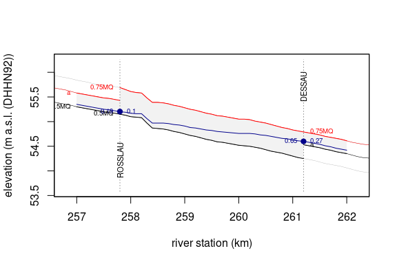
plotShiny(wldf, TRUE, TRUE, TRUE, xlim = c(256.8, 262.2))