flexurba
Construct Flexible Urban Delineations
Enables the construction of flexible urban delineations that
can be tailored to specific applications or research questions, see Van
Migerode et al. (2024)
Flexurba
Flexurba is an open-source R package to construct flexible urban delineations which can be tailored to specific applications or research questions. The package was originally developed to flexibly reconstruct the Degree of Urbanisation (DEGURBA) classification, but has since been expanded to support a broader range of delineation approaches.
The source code of the package is available on this repository and the documentation of all functions can be found on this website.
Citation
To acknowledge the use of the package and for an extensive description of its contribution, please refer to the following journal article:
Van Migerode, C., Poorthuis, A., & Derudder, B. (2024). Flexurba: An open-source R package to flexibly reconstruct the Degree of Urbanisation classification. Environment and Planning B: Urban Analytics and City Science, 51(7), 1706-1714.
Installation
The flexurba package can be installed as follows:
install.packages("flexurba")
Important notes for installation:
-
The
flexurbapackage usesC++code for certain functions. Please make sure to have MAKE installed on your computer. -
While installing the package, R will give a prompt to install Rtools (if not already installed). Please click
YESand make sure you have appropriate administrator rights.
Using flexurba
1. Reconstructing the DEGURBA grid classification
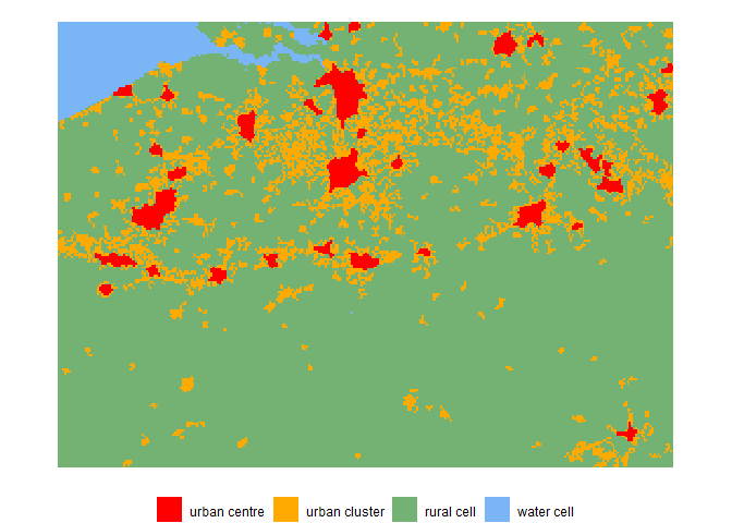
The DEGURBA methodology classifies the cells of a 1 km² population grid into three different categories based on the following rules (detailed in the GHSL Data Package 2023):
- Urban Centres are clusters of cells (rooks continuity) with a minimum population density of 1500 inhabitants per km² of permanent land or a minimum ‘optimal’ built-up area threshold. In addition, the total population in these clusters should be at least 50 000. Gaps in the urban centres are filled and edges are smoothed.
- Urban Clusters are clusters of cells (queens continuity) with a minimum population density of 300 inhabitants per km² of permanent land and a minimum total population of 5000 inhabitants. Cells that belong to urban centres are removed from urban clusters.
- Rural grid cells do not belong to an urban centre or cluster.
We can reconstruct the standard grid cell classification for Belgium as follows.
library(flexurba)

# load the example data for Belgium
data_belgium <- DoU_load_grid_data_belgium()

# run the DEGURBA algorithm with the standard parameter settings
classification1 <- DoU_classify_grid(data = data_belgium)

# plot the resulting grid
DoU_plot_grid(classification1)
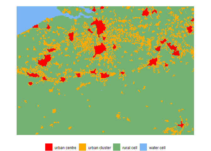
The function DoU_classify_grid() also allows to adapt the standard
parameters in the DEGURBA algorithm. For example, the population
thresholds for urban centres can be adapted by changing the following
parameters:
-
UC_density_threshold = 1250: the minimum density threshold for urban centres (UC) is changed to 1250 inhabitants per km² instead of the standard value of 1500 inhabitants per km². -
UC_size_threshold = 60000: the minimum size threshold for urban centres (UC) is increased from 50 000 inhabitants to 60 000 inhabitants.
# run the algorithm with custom parameter settings
classification2 <- DoU_classify_grid(
  data = data_belgium,
  # here, we can specify custom population thresholds
  parameters = list(
    UC_density_threshold = 1250,
    UC_size_threshold = 60000
  )
)

# plot the resulting grid
DoU_plot_grid(classification2)
For more information about the possible parameters settings, see the
section ‘Custom specifications’ in the documentation of
DoU_classify_grid().
2. Identifying urban areas by thresholding gridded datasets
Apart from DEGURBA, several other delineation approaches enforce
thresholds on gridded datasets. The accompanying
flexurbaData
package provides pre-processed datasets that can serve as proxy to
identify urban areas. We can construct urban boundaries based on these
proxy datasets using the function apply_threshold(). The code examples
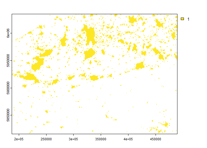
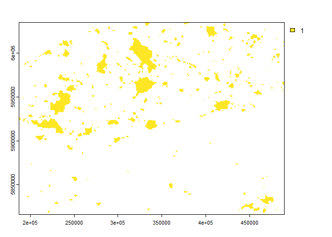
below enforce a predefined threshold on (1) built-up area and (2)
night-time light data.
# (1) predefined threshold of 15% built-up area

# load the example proxy data for Belgium
proxy_data_belgium <- load_proxies_belgium()

# apply the threshold
builtupclassification <- apply_threshold(proxy_data_belgium$built,
  type = "predefined",
  threshold_value = 0.15
)

# plot the resulting urban boundaries
terra::plot(builtupclassification$rboundaries)
# (2) predefined threshold of 15 nW/cm³/sr

# apply the threshold
lightclassification <- apply_threshold(proxy_data_belgium$light,
  type = "predefined",
  threshold_value = 15
)

# plot the resulting urban boundaries
terra::plot(lightclassification$rboundaries)
Besides a predefined threshold, the function apply_threshold() also
implements other types of thresholding approaches. For more information
on these, see vignette("vig8-apply-thresholds").
Vignettes
For more code examples, please consult the documentation pages of the
individual functions. The following vignettes are also available with
more information and workflows using flexurba:
- The
vignette("flexurba")is a “Get Started” tutorial on usingflexurbato reconstruct DEGURBA. It shows how to download the data from the GHSL website, construct a grid cell classification and a spatial units classification. - The
vignette("vig1-DoU-level2")showcases how the grid cell and spatial units classification can be constructed according to second hierarchical level of DEGURBA. - The
vignette("vig2-DoU-multiple-configurations")gives an overview on how to use the package to generate multiple alternative versions of DEGURBA by systematically varying parameters in the algorithm. - The
vignette("vig3-DoU-global-scale")explains how a global DEGURBA classification can be established in a memory-efficient manner. - The GHSL released different versions of the Degree of Urbanisation
in the past years. The
vignette("vig4-DoU-comparison-releases")compares the method described in Data Packages 2022 with the method described in Data Package 2023. - The
vignette("vig5-DoU-computational-requirements")elaborates on the computational requirements of the package to reconstruct the DEGURBA classification, and compares the computational load with the existing GHSL tools. - The
vignette("vig6-DoU-comparison-GHSL-SMOD")compares the DEGURBA grid classification generated byflexurbawith the official GHSL SMOD layer and explains few discrepancies between the two classifications. - The
vignette("vig7-DoU-population-grid")illustrates how the DEGURBA functionalities can be used with other population grids (e.g. WorldPop). - The
vignette("vig8-apply-thresholds")elaborates on the benefits and limitations of different thresholding approach implemented by the functionapply_threshold(). - The
vignette("vig9-different-proxies")illustrates how different proxy datasets can be used to identify urban areas using a combination of the data in theflexurbaDatapackage and the functions in theflexurbapackage.
Disclaimer: The flexurba package includes a reconstruction of
DEGURBA’s algorithm, and by no means contains an official
implementation. For the official documents, readers can consult
Dijkstra et al. (2021),
Eurostat
(2021)
and the Global Human Settlement Layer
website.