maposm
Get Map Layers from 'OpenStreetMap'
The 'OpenStreetMap' database provides a wide range of highly detailed geographic layers on a global scale. To obtain synthetic information for cartographic purposes, layers must be selected, simplified, merged, or modified. 'maposm' downloads 'OpenStreetMap' extracts and performs these operations to create a set of composite layers of urban areas, buildings, green spaces, main roads, secondary roads, railways, and water bodies.
maposm 

The OpenStreetMap database provides a
wide range of highly detailed geographic layers on a global scale. To
obtain synthetic information for cartographic purposes, layers must be
selected, simplified, merged, or modified.
maposm downloads OpenStreetMap extracts and performs these operations
to create a set of composite layers of urban areas, buildings, green
spaces, main roads, secondary roads, railways, and water bodies.
Installation
You can install maposm from the r-universe.
install.packages('maposm', repos = c('https://riatelab.r-universe.dev', 'https://cloud.r-project.org'))
Demo
om_get() is used to download, merge and simplify the geographic
layers.
om_map() is used to map the layers.
library(maposm)
#> Data © OpenStreetMap contributors, ODbL 1.0. https://www.openstreetmap.org/copyright.
#> Maps based on OpenStreetMap data should cite "© OpenStreetMap contributors" as the data source.
f2f = om_get(x = c(-61.070, 14.605), r = 600)
#> # Download the OpenStreetMap file
#> The input place and the radius matched the sample dataset.
#> Skip download and data extraction.
#>
#> # Create map layers
#> - green spaces
#> - buildings
#> - urban areas
#> - roads
#> - streets
#> - railways
#> - water bodies
#>
#> Done!
om_map(x = f2f, title = "Fort-de-France, Martinique", theme = "light")
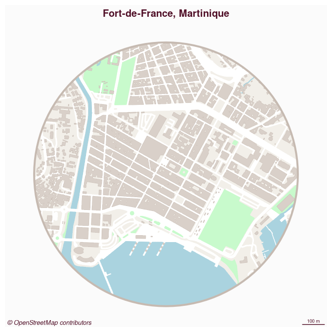
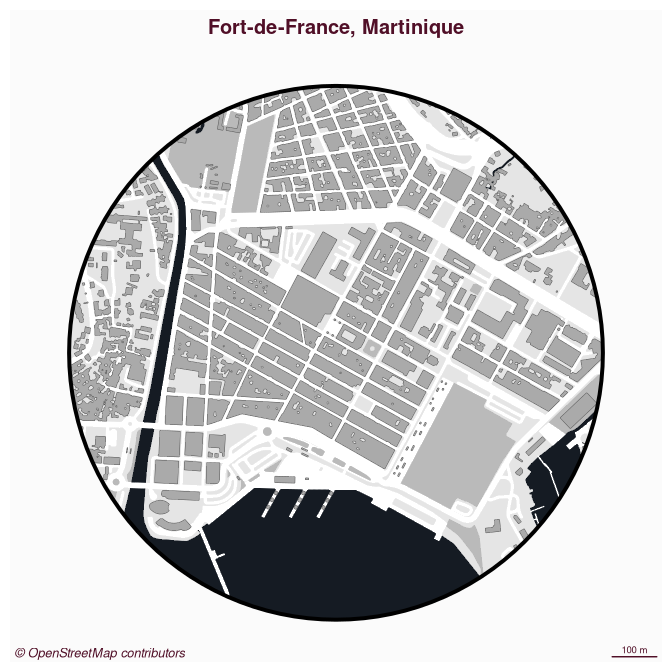
Several themes are available to map the layers (“light”, “dark”, “grey” and “pizza”).
om_map(x = f2f, title = "Fort-de-France, Martinique", theme = "grey")
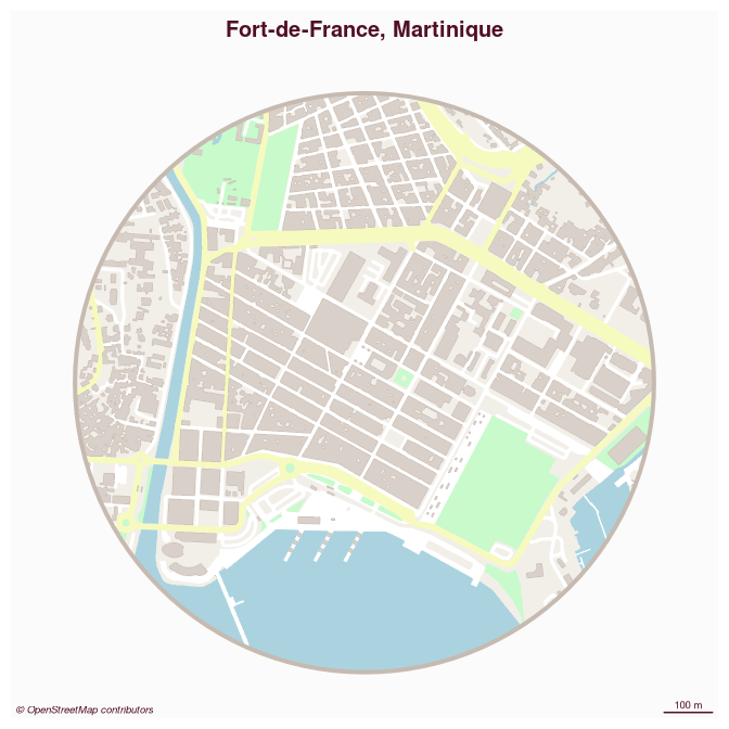
You can also use your prefered library to map the layers.
library(mapsf)
mf_map(f2f$zone, col = "#f2efe9", border = NA, add = FALSE)
mf_map(f2f$urban, col = "#e0dfdf", border = "#e0dfdf", lwd = .5, add = TRUE)
mf_map(f2f$green, col = "#c8facc", border = "#c8facc", lwd = .5, add = TRUE)
mf_map(f2f$water, col = "#aad3df", border = "#aad3df", lwd = .5, add = TRUE)
mf_map(f2f$railway, col = "grey50", lty = 2, lwd = .2, add = TRUE)
mf_map(f2f$street, col = "white", border = "white", lwd = .5, add = TRUE)
mf_map(f2f$road, col = "#f7fabf", border = "#f7fabf", lwd = .5, add = TRUE)
mf_map(f2f$building, col = "#d9d0c9", border = "#c6bab1", lwd = .5, add = TRUE)
mf_map(f2f$zone, col = NA, border = "#c6bab1", lwd = 4, add = TRUE)
mf_credits(txt = "\ua9 OpenStreetMap contributors")
mf_scale(size = 100, scale_units = "m")
mf_title("Fort-de-France, Martinique")
om_write() can be used to write the layers to a geopackage file.
om_read() can be used to read these geopackages.
# save
om_write(x = f2f, filename = "f2f.gpkg")
# import
om_read(x = "f2f.gpkg")
Alternatives
osmdatato access to OSM data through the overpass APIosmplotrfrom the author ofosmdataosmextractfor large extracts from OSMprettymapsis a full featured Python librarymapBlissto plot flight paths and road trips on OSM mapmaptilesto download (raster) OSM map tilescartographrto plot OSM layers usingggplot2rcityviewsto map cities, it has ashinyinterface
Community Guidelines
One can contribute to the package through pull requests and report issues or ask questions here. This project uses conventional commits and semantic versioning.