ffm
Download Official Spatial Data from Germany
Provides quick and easy access to official spatial data from Germany’s Federal Agency for Cartography and Geodesy (BKG) < https://gdz.bkg.bund.de/>. Interfaces various web feature services (WFS) and download servers. Allows retrieval, caching and filtering with a wide range of open geodata products, including administrative or non-administrative boundaries, land cover, elevation models, geographic names, and points of interest covering Germany. Can be particularly useful for linking regional statistics to their spatial representations and streamlining workflows that involve spatial data of Germany.
ffm 



{ffm} is an R package that provides quick and easy access to data from
the geodata center of Germany’s Federal Agency for Cartography and
Geodesy (BKG). The BKG is the official provider of spatial data in
Germany and provides quite a few datasets as open data. These data range
from administrative areas to earth observation data and are often
crucial when working with regional statistics from Germany. Part of the
motivation for this package stems from frustration when working areal
identifiers returned by packages like {wiesbaden} or {restatis} and
not being able to quickly link them to their spatial representations.
The name ffm is based on the colloquial short name of Frankfurt am
Main where the BKG’s headquarters are located.
Gallery
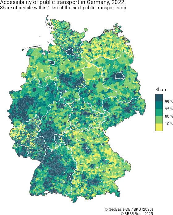
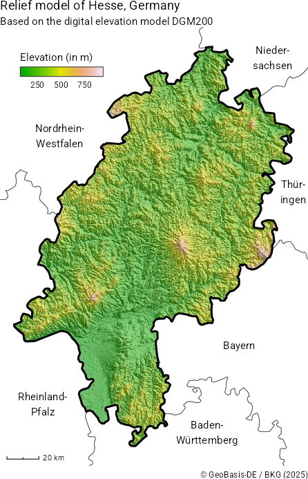
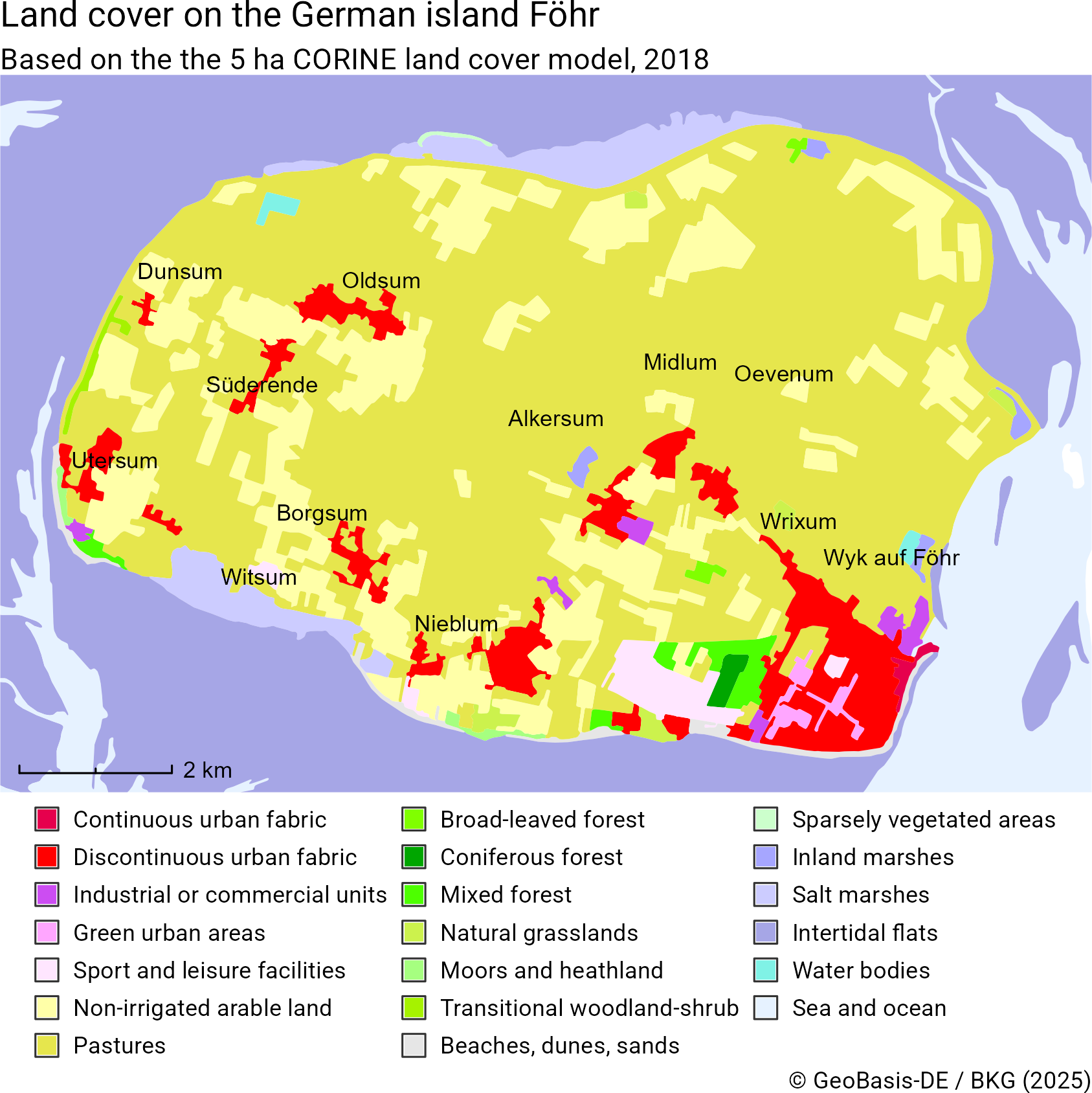
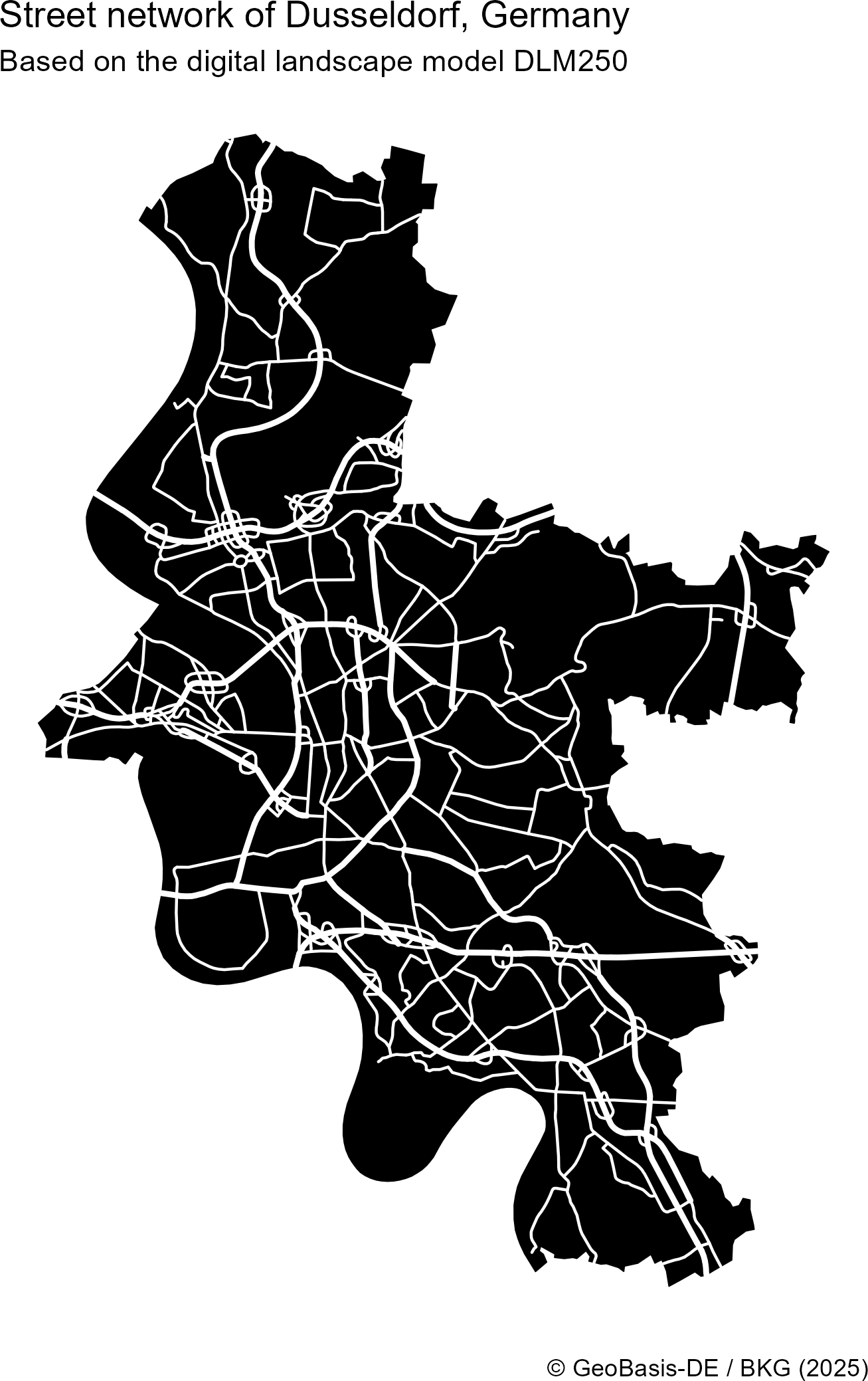
The following examples were created using {ffm}. You can see their
code in the examples/ directory.
|
|
|
|
Installation
You can install the development version of ffm from GitHub with:
# install.packages("pak")
pak::pak("jslth/ffm")
Example
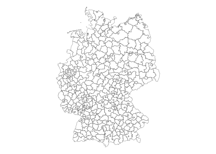
Retrieving data is pretty straightforward:
library(ffm)
districts <- bkg_admin(level = "krs", scale = "5000")
Code for the plot
library(ggplot2)

ggplot(districts) +
  geom_sf(fill = NA) +
  theme_void()
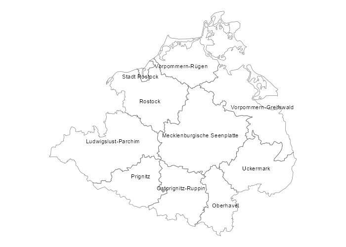
The package makes it easy to go deeper than just getting the data. In many functions, you can use spatial filters.
districts <- bkg_admin(
  level = "krs",
  scale = "5000",
  bbox = c(xmin = 700000, ymin = 5900000, xmax = 850000, ymax = 6000000),
  predicate = "intersects"
)
districts$label <- ifelse(
  districts$bez == "Kreisfreie Stadt",
  paste("Stadt", districts$gen),
  districts$gen
)
Code for the plot
library(ggrepel)

ggplot(districts) +
  geom_sf(fill = NA) +
  geom_text_repel(
    aes(label = label, geometry = geometry),
    stat = "sf_coordinates",
    size = 3
  ) +
  theme_void()
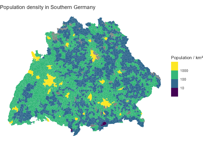
Attribute filters are supported using an R-like syntax.
munics <- bkg_admin(
  level = "gem",
  key_date = "1231",
  sn_l %in% c("08", "09")
)
Code for the plot
munics$popdens <- munics$ewz / munics$kfl
munics$popdens[munics$popdens == 0] <- NA
ggplot(munics) +
  geom_sf(aes(fill = popdens), color = NA) +
  scale_fill_viridis_b("Population / km²", transform = "log10") +
  ggtitle("Population density in Southern Germany") +
  theme_void()
Supported products
| Function | Description | BKG products |
|---|---|---|
bkg_admin |
Administrative boundaries at different spatial scales; includes country, state, government region, district, administrative associations, and municipalities | vg250 and related products |
bkg_admin_hierarchy |
Administrative boundaries containing details on their relationship to administrative areas of higher levels in the territorial hierarchy | vz250 |
bkg_admin_highres |
Administrative boundaries at a significantly lower resolution that provided by bkg_admin() |
vg25 |
bkg_ags |
Geographical names associated with official keys (AGS and ARS) | wfs_gnde |
bkg_airports |
International, regional, and special airports in Germany | wfs_poi_open |
bkg_amr |
Labor market regions (Arbeitsmarktregionen) | ge250 and related products |
bkg_area_codes |
Area code regions (Vorwahlgebiete) | wfs_gnde |
bkg_ars |
Geographical names associated with official keys (AGS and ARS) | wfs_gnde |
bkg_authorities |
Regions of administrative responsibility for several agencies (Behördenzuständigkeitsbereiche) | wfs_bzb_open |
bkg_bkr |
Lignite extraction regions (Braunkohlereviere) | ge250 and related products |
bkg_clc |
Land cover areas based on the Corine Land Cover (CLC) nomenclature | wfs_clc5 |
bkg_crossings |
International border crossings | wfs_poi_open |
bkg_dem |
Elevation raster from the digital elevation model (DEM) | dgm200 |
bkg_dlm |
Topographical objects of a landscape from the Digital Landscape Model (DLM) | dlm250 and related products |
bkg_endonyms |
Geographic names as endonyms | wfs_gnde |
bkg_geonames |
Geographic name metadata based on National Name Identifiers (NNID) | wfs_gnde |
bkg_ggr |
City regions (Großstadtregionen) | ge250 and related products |
bkg_grid_full |
INSPIRE-compliant grid geometries (GeoGitter) | GeoGitter |
bkg_heliports |
Heliports | wfs_poi_open |
bkg_kfz |
Vehicle registration plate regions (KFZ-Kennzeichen) | kfz250 |
bkg_kilometrage |
Kilometrages of German federal motorways | wfs_poi_open |
bkg_kmr |
Metropolitan regions (Metropolregionen) | ge250 and related products |
bkg_krg |
District regions (Kreisregionen) | ge250 and related products |
bkg_mbe |
BBSR Mittelbereiche | ge250 and related products |
bkg_mkro |
Conurbations (Verdichtungsräume) | ge250 and related products |
bkg_nuts |
NUTS regions of scale 1 to 3 from the EU territorial division | bkg_nuts250 and related products |
bkg_quasigeoid |
German Combined Quasigeoid, the official height reference surface of the German land survey | quasigeoid |
bkg_rg |
Travel areas (Reisegebiete) | ge250 and related products |
bkg_ror |
Spatial planning regions (Raumordnungsregionen) | ge250 and related products |
bkg_seaports |
Seaports to the North and Baltic Sea | wfs_poi_open |
bkg_stations |
Public transport stations and stops | wfs_poi_open |
bkg_trauma_centers |
Trauma centers | wfs_poi_open |
Related packages
{giscoR}for retrieving EU geodata (also including Germany){bonn}for retrieving German areal indicators with official identifiers{restatis}and{wiesbaden}for retrieving regional statistics from Germany{z22}for retrieving gridded German census data{rdwd}for retrieving German weather and climate data
Copyright notice
BKG geodata is provided free of charge but remains copyrighted and subject to BKG licensing. They are licensed under the German Open Data license dl-de/by-2-0 and can be used both commercially and non-commercially with attribution.
When incorporating BKG geodata, please include the following attribution. Update the year to match your data acquisition data and keep the links intact.
- If data modified: © BKG (date of last access) dl-de/by-2-0 (data edited)
- If not modified: © BKG (date of last access) dl-de/by-2-0
This is a summary based on the BKG copyright notice
Disclaimer
This package is an independent project and is not affiliated with, endorsed by, or officially connected to the Federal Agency for Cartography and Geodesy (Bundesamt für Kartographie und Geodäsie, BKG) in any way. All references to data, services, or resources provided by the BKG are for informational purposes only.