hillshader
Create Hillshade Relief Maps Using Ray-Tracing
A set of tools to create georeferenced hillshade relief raster maps using ray-tracing and other advanced hill-shading techniques. It includes a wrapper function to create a georeferenced, ray-traced hillshade map from a digital elevation model, and other functions that can be used in a rayshader pipeline.
hillshader

The hillshader package is a wrapper around the rayshader and
raster packages to create hillshade relief maps using ray-tracing, and
write them to (spatial) files.
Installation
The stable version of hillshader can be installed from CRAN:
install.packages("hillshader")
Alternatively, if you feel brave, you can install the development
version of hillshader with the remotes package:
remotes::install_github("pierreroudier/hillshader")
First steps
Below is a quick tutorial of the hillshader capabilities:
The hillshader function
The hillshader function is the main function of that package, and
allows to create a hillshade map as a RasterLayer:
library(raster)
#> Loading required package: sp
library(rayshader)

library(hillshader)
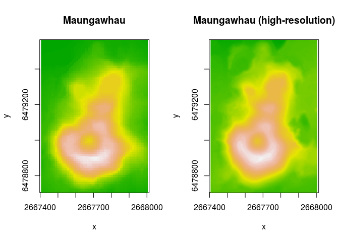
Note that the hillshader package includes the maungawhau and
maungawhau_hr datasets. These are geo-referenced, raster datasets.
maungawhau corresponds to the well-known volcano dataset. It is a
87 × 61 elevation matrix for
Maungawhau, one
of the circa 80 volcanoes in the Auckland volcano filed, in Aotearoa/New
Zealand. The maungawhau_hr dataset is a “high-resolution” version of
that dataset, and is a 1 m resolution, 860 × 600 elevation matrix
derived from a LiDAR dataset recorded by NZ Aerial Mapping & Aerial
Surveying Limited for Auckland Council, and distributed by Land
Information New
Zealand.
layout(matrix(c(1,2), nrow = 1, ncol = 2))
image(maungawhau, asp = 1, main = "Maungawhau", col = terrain.colors(100))
image(maungawhau_hr, asp = 1, main = "Maungawhau (high-resolution)", col = terrain.colors(100))
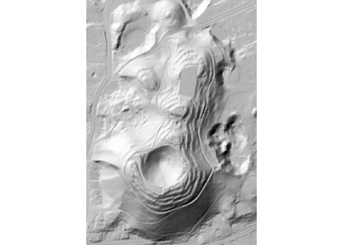
The hillshader function can be simply called on a elevation raster to
generate a hillshade RasterLayer. By default, the shader used is
rayshader::ray_shade, with its default values.
hs <- hillshader(maungawhau_hr)
plot_map(hs)
Add more shaders!
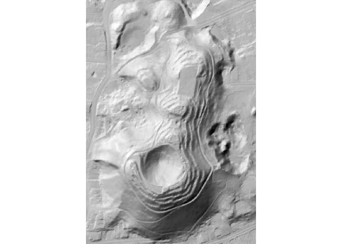
The hillshader function accept a shader option, with is a list of
the successive shader functions to apply to create the hillshade layer.
The accepted values must be rayshader shader functions (ray_shade,
ambient_shade, lamb_shade), and the order is important.
hs <- hillshader(
  elevation = maungawhau_hr,
  shader = c("ray_shade", "ambient_shade")
)

plot_map(hs)
Changing sun position
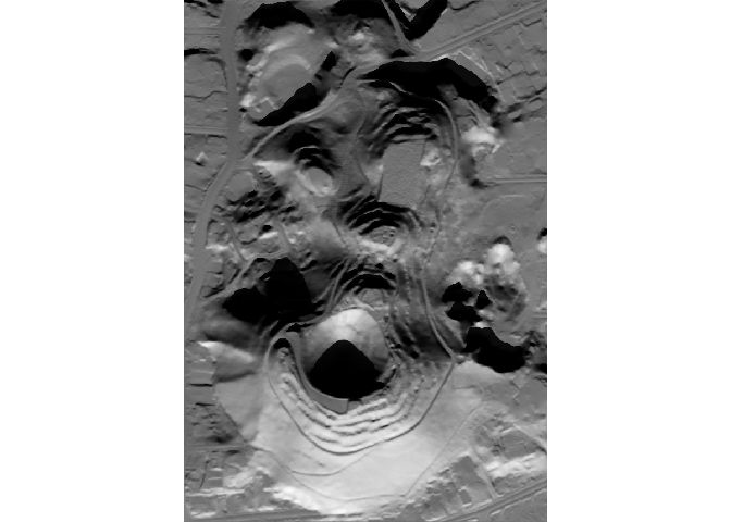
The hillshader function uses the rayshader options defaults, but
other values can be specify and passed as arguments:
hs <- hillshader(
  elevation = maungawhau_hr,
  shader = c("ray_shade", "ambient_shade"),
  sunangle = 180,
  sunaltitude = 25
)

plot_map(hs)
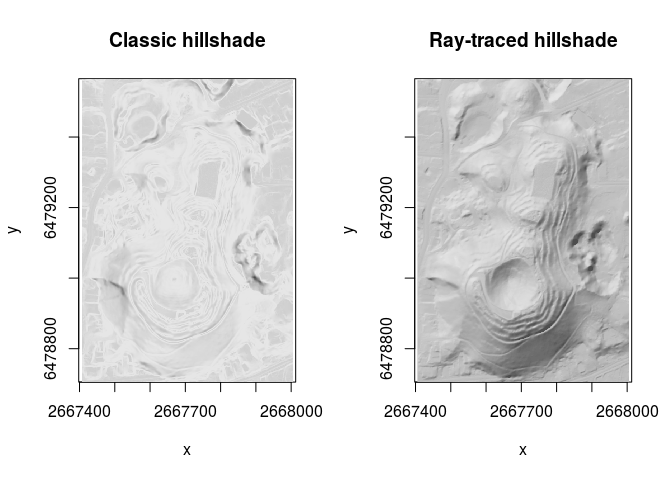
How does it compare to your usual hillshade method?
library(raster)

slope <- terrain(maungawhau_hr, out = "slope")
aspect <- terrain(maungawhau_hr, out = "aspect")
hs_raster <- hillShade(
  slope,
  aspect,
  angle = 40,
  direction = 325
)

hs_hillshader <- hillshader(
  maungawhau_hr,
  c("ray_shade", "ambient_shade"),
  sunangle = 325,
  sunaltitude = 40
)

layout(matrix(c(1,2), nrow = 1, ncol = 2))
image(hs_raster, asp = 1, main = "Classic hillshade", col = grey.colors(100))
image(hs_hillshader, asp = 1, main = "Ray-traced hillshade", col = grey.colors(100))
Saving to file
If a filename is passed to hillshader, then the resulting hillshade
layer is saved to file. This is a wrapper around raster::writeRaster,
and options specific to the latter function can be used.
hillshader(
  elevation = maungawhau_hr,
  shader = c("ray_shade", "ambient_shade"),
  sunangle = 180,
  sunaltitude = 25,
  filename = "hillshade.tif"
)
Advanced use in the rayshader pipelines
The hillshader package provides three functions that can be used
within the rayshader pipelines:
add_shadow_2d: a function that multiplies a shadow map by another shadow map, a corrected 2D version ofrayshader::add_shadow,matrix_to_raster: a function that converts a matrix (typically used by therayshaderfunctions) back to aRasterLayer, for input into a GIS workflow,write_raster: a function that a hillshade matrix to a raster file format.
library(rayshader)
library(hillshader)

# Create elevation matrix
el_mat <- raster_to_matrix(maungawhau_hr)

el_mat %>%
  # Create hillshade layer using
  # ray-tracing
  ray_shade %>%
  # Add ambient shading
  add_shadow_2d(
    ambient_shade(
      heightmap = el_mat
    )
  ) %>%
  # Write to GIS file
  write_raster(
    elevation = maungawhau_hr,
    filename = "hillshade.tif"
  )
Code of Conduct
Please note that the hillshader project is released with a Contributor Code of Conduct. By contributing to this project, you agree to abide by its terms.